Late Palaeolithic
Cave and darkness
Engravings at Creswell Crags show deep-time symbolic engagement with a natural subterranean place.
Creswell CragsAncient names · Ritual landscapes · Degrees of evidence
Mapping Britain’s proposed nemeta within a deeper ritual landscape
No specialist knowledge is needed. The map distinguishes what is documented, what is linguistically plausible and what remains an evocative but unproven interpretation.
How do we map sacred places when the people who used them left few monuments—and no written records of their own?
I · Before the Druids
Britain’s proposed sacred groves belonged within a much older history of caves, wetlands, rivers, hilltops, monuments and routes invested with meaning. This does not prove one unbroken religion. It shows that successive communities repeatedly made the landscape part of ritual life.
Late Palaeolithic
Engravings at Creswell Crags show deep-time symbolic engagement with a natural subterranean place.
Creswell CragsMesolithic
Star Carr links animals, water, hunting and possible ritual identity through modified deer-skull frontlets.
Star CarrNeolithic
Henges, tombs, circles and avenues shaped how people approached and experienced ceremonial landscapes.
Stonehenge · OrkneyBronze Age
Causeways and wetlands became settings for movement, deposition and long-lived communal memory.
Flag FenIron Age
Built shrines, islands and natural sanctuaries formed the ritual world into which the nemeton belonged.
Hayling Island · MonaA necessary distinction
A spring, island or hill can attract meaning in several periods for different reasons. The investigation separates direct continuity from later reuse, inherited names and repeated choice.
II · Mapping the unwritten
No single artefact proves that an entire landscape was sacred. Archaeologists combine physical evidence, environmental reconstruction, names, movement, visibility and ancient testimony.
Spring, cave, island, river crossing, prominent ridge or hill.
Road, avenue, causeway, tidal crossing or controlled approach.
What could be seen, and when did monuments or landmarks appear?
Were objects, animals or remains deliberately placed?
Do pollen and sediment reveal clearance or managed woodland?
Does an ancient or later name preserve a sacred-place element?
Evidence used on the map
III · The interactive map
Markers identify documented landscapes, ancient names, modern place-name proposals and comparative sites. Every location explains what survives and what remains uncertain.
Guided journey
Follow six interpretive stops, or select any marker and explore at your own pace.
IV · Mona: the exceptional case
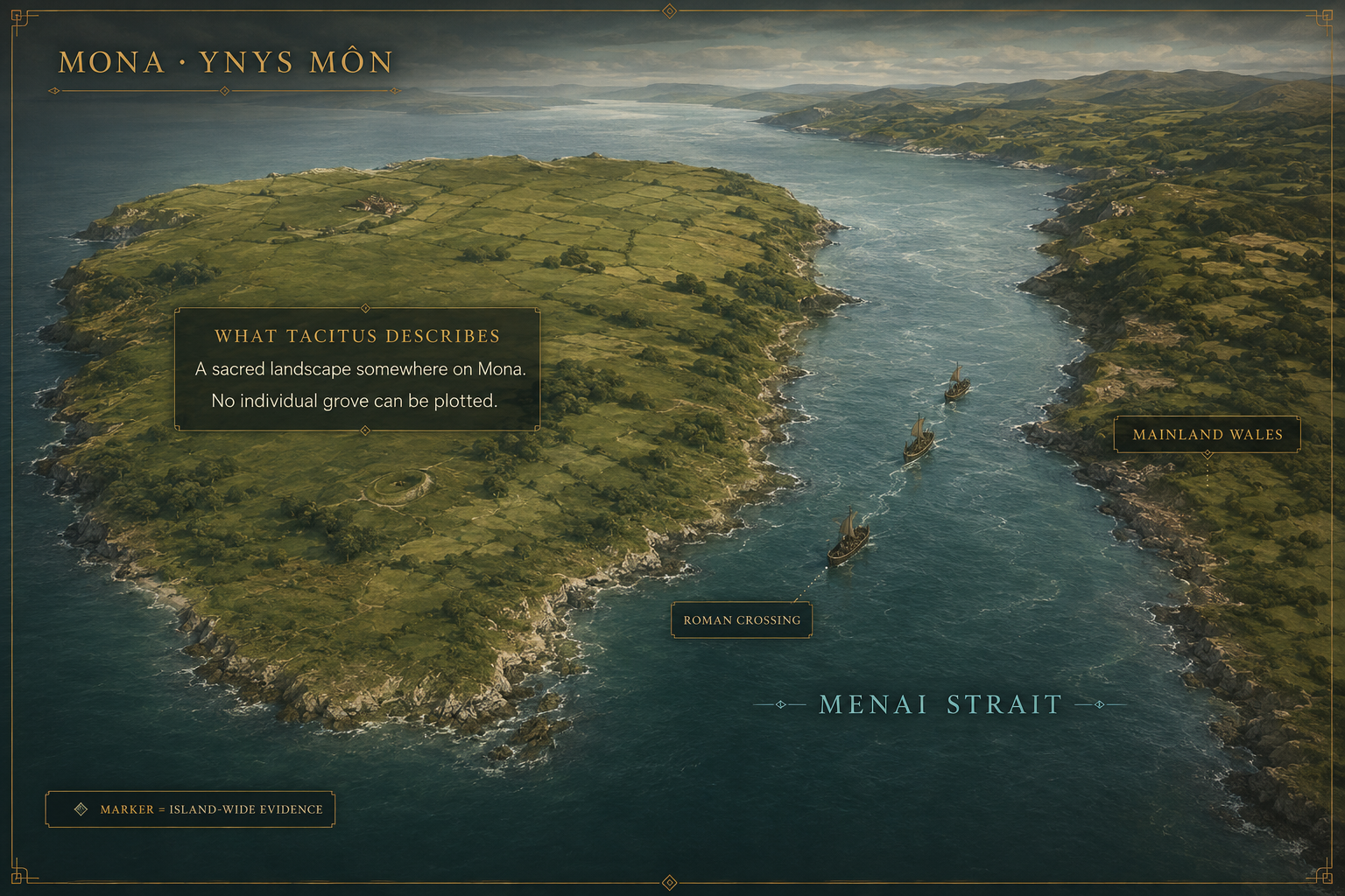
What the ancient text gives us
In his account of the assault of AD 60/61, Tacitus places Druids on the opposing shore and says that sacred groves were destroyed after the conquest. That makes Mona the clearest historically attested ritual landscape here.
An ancient narrative associates Mona with Druids and destroyed groves.
The account does not identify grove locations, extent or archaeological form.
Tacitus wrote a Roman literary account shaped by imperial assumptions.
Responsible label: documented sacred landscape; exact groves unlocated.
Continue to Agricola and the Druids of MonaV · Regional stories
Devon · The Nymet cluster
The Ravenna Cosmography preserves Nemetostatio, usually linked with North Tawton. Nearby Nymet names may preserve a regional sacred-place vocabulary.
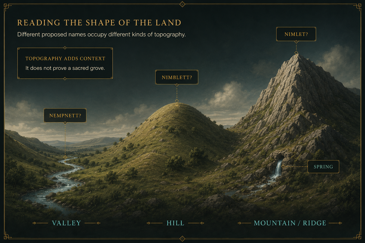
Bath and Somerset · Four proposals
Richard Dunn compared four possible descendants of nemeton with local topography and archaeology. His conclusion was deliberately cautious: the hypothesis has merit, but further work is needed.
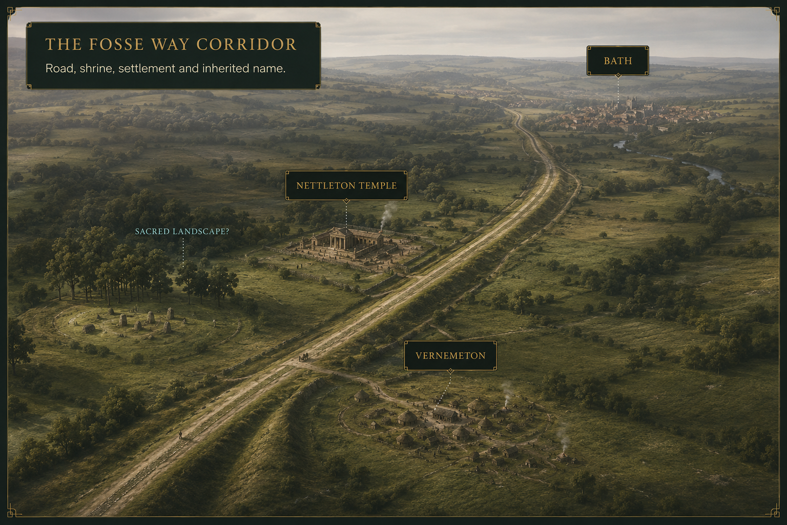
The Fosse Way · Names and ritual complexes
Vernemeton entered Roman route geography. Nettleton developed a major temple complex beside the Fosse Way, but its modern name is not secure proof of a nemeton.
VI · Rome enters sacred ground
Mona’s groves appear in a Roman narrative of conquest and destruction.
MonaHayling Island’s Iron Age shrine was succeeded by a Roman stone temple on the same plan.
Hayling IslandNettleton grew from shrine into a substantial temple and settlement complex.
Nettleton ShrubSacred-place elements survived within names used by Roman geographers.
Nemetostatio · VernemetonMedionemeton may lie near Bar Hill–Croy Hill, but remains unlocated.
Antonine frontier?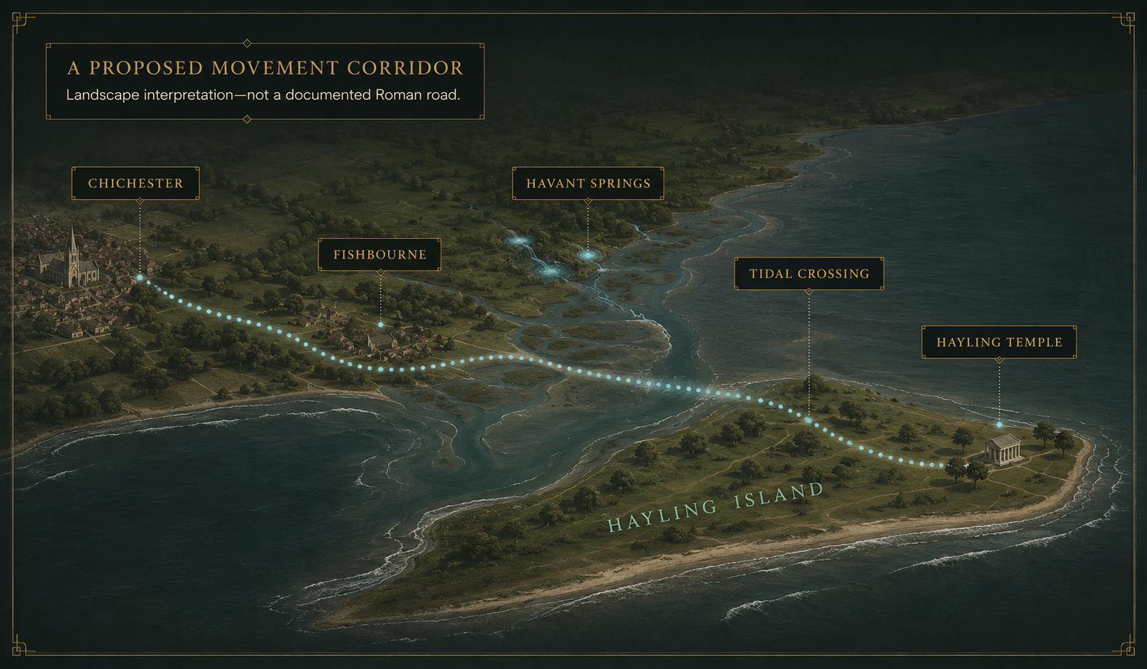
A bridge across the conquest
Structural sequence and continued deposition link Late Iron Age and Roman worship. A recent study proposes a wider processional landscape from the Chichester region to the island.
Even here, the processional route remains an archaeological reconstruction—not a documented itinerary.
Read the open-access study →VII · Continuity—or repeated sacred choice?
A grove, spring, shrine, island, hill or route may already have mattered before Roman contact.
The answer determines how strong a continuity claim can responsibly be.
Structure and practice survive
A shrine is rebuilt or recognisable ritual practice continues across the transition.
Strongest example: Hayling IslandThe place is reused
A Roman temple, fort or route occupies a landscape that may already have held significance.
Possible: North Tawton, NettletonOnly the name survives
The original practice disappears while a sacred-place element remains embedded in a later name.
Examples: Nymet, VernemetonThe landscape attracts meaning again
Different communities invest the same water, island, hill or crossing with new meanings.
Not proof of one continuing institutionDirect continuity can support a strong archaeological claim. A surviving name or repeated landscape choice supports a more cautious statement about memory, reuse or possibility.
Language for a trustworthy map
documented sacred landscape
ancient sacred-place name
proposed linguistic survival
archaeological association
approximate or unlocated
known Druid temple
site of Druid ceremonies
Roman fort built to destroy the grove
continuous worship for millennia
proof from name alone
A responsible map does not remove mystery. It shows exactly where the mystery begins: between a surviving word, an altered landscape and the evidence needed to connect them.
VIII · Go deeper
The guided page contains the main explanation. These links are optional deeper reading.
The assault on Mona and destruction of sacred groves.
Open the translation → Place-name researchRichard Dunn’s cautious study of the Bristol and Bath proposals.
Open the paper record → Historic Environment RecordThe name, Roman complex, prehistoric features and conjectural sanctuary interpretation.
Open the record → Scheduled archaeologyLate Iron Age features, shrines, temple development and associated settlement.
Open the official record → Unresolved geographyThe proposal connecting the name with the Bar Hill–Croy Hill landscape.
Open the ADS record → Iron Age–Roman transitionTemple continuity and a proposed regional processional landscape.
Read the paper → Related investigationMove from sacred landscape to Roman campaign reconstruction.
Explore the campaign → Related methodHow landscape archaeology reveals—and sometimes misidentifies—lost routes.
Explore Ghost Roads → Roman Storyworld archiveBrowse the wider evidence base and long-form research.
Open the archive →IX · Sources and research foundation
North Tawton, Nemetostatio and the surrounding archaeological landscape.
Open record →Official evidence for the temple complex and Late Iron Age features.
Open record →Research dating Britain’s earliest known Pleistocene cave engravings.
Open report →Official mapping and research on the wider monument complex.
Open maps →The connected domestic, burial and ceremonial landscape.
Open page →Scheduled wetland archaeology and Bronze Age timber alignment.
Open record →Hayling Island, ritual continuity and a proposed processional route.
Open paper →What to take away
Some places are documented. Some are strongly supported. Others remain linguistic proposals whose attraction lies in the questions they preserve.
The map is not a map of where the Druids certainly stood. It is a map of where evidence, memory and landscape still meet.