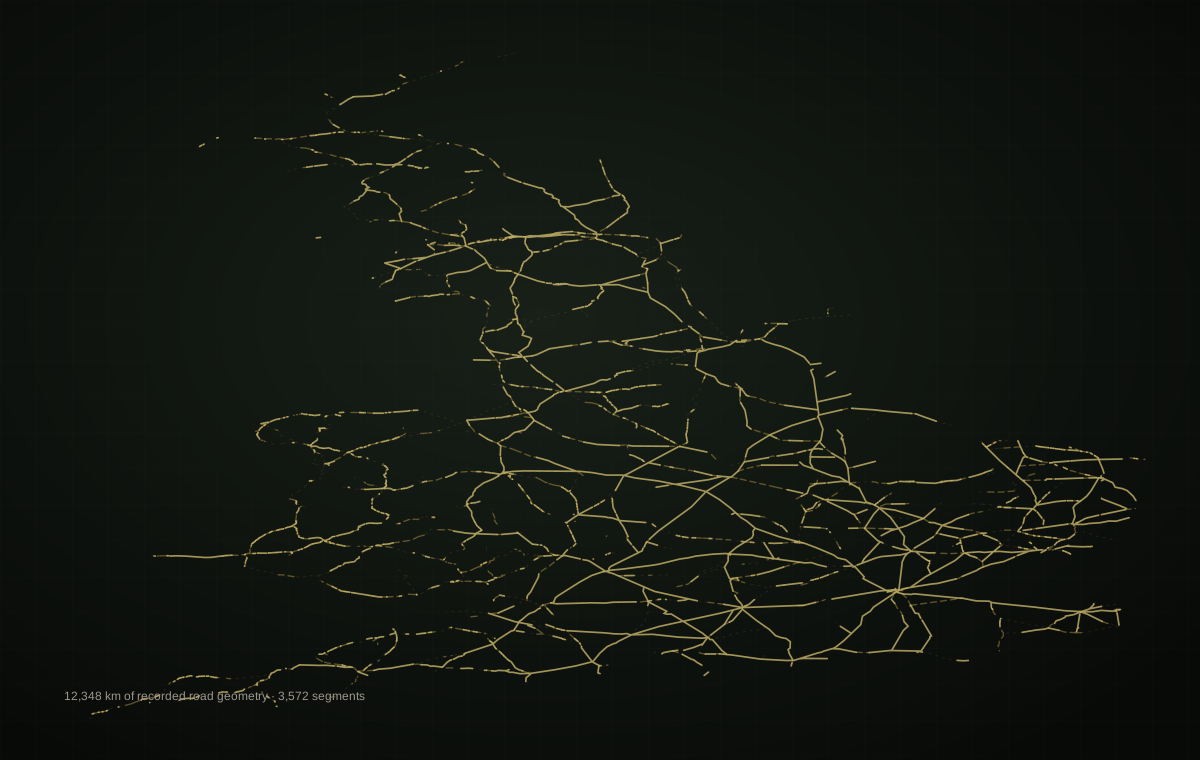
The simplified picture
A road joins two important places
Fort to fort. Town to town. A useful line on a historical map—but only the beginning of the story.
Digital Britannia investigation
Were Roman roads merely routes between forts and towns—or did they form a much denser working landscape whose traces still shape Britain today?
Begin with the roads. Then add military power, settlements, temporary camps and milestones. Each layer changes the meaning of the network.
I · Begin with the wrong picture
The familiar schoolbook image is a handful of bold routes connecting London, York, Chester and the frontier. Digital Britannia records something denser: major roads, secondary roads, short engineered sections, uncertain continuations and local links that draw forts, towns and smaller settlements into a working system.1
The simplified picture
Fort to fort. Town to town. A useful line on a historical map—but only the beginning of the story.
The working landscape
Forts, vici, farms, markets, river crossings, quarries, mines, shrines and temporary camps could all depend on movement through the same corridor.
The density is not created by famous names. Most segments in the dataset are not labelled “Watling Street”, “Fosse Way” or another recognised historic road name. The network is larger than the part remembered by name.
II · Reveal the evidence
This is not a map to decipher unaided. Choose a stage and the explanation below tells you what has changed. Every line and point is derived from the supplied Digital Britannia GeoPackage.
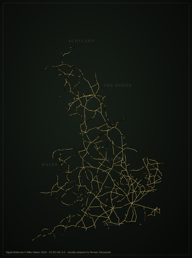
Stage 01 · Roads only
Digital Britannia records 3,572 engineered road segments with approximately 12,348 km of geometry. The result resembles a web rather than a few isolated lines.

III · Test the relationship
Each point was measured to the nearest recorded engineered road segment using British National Grid coordinates. The result does not prove that a road caused every site—but it tests whether the layers repeatedly occupy the same landscape.
517 records
within 1 km of a recorded road
485 records
within 1 km of a recorded road
617 records
within 1 km of a recorded road
137 records
within 1 km of a recorded road
What the closeness suggests
Military installations are closely related to routes, as expected. Settlements are closer still in this dataset. That pattern is consistent with roads becoming places of exchange, administration, craft, supply and long-term residence, not merely corridors used by marching soldiers.
Why camps look different
Camps are more dispersed and their median road distance is greater. Some may pre-date a permanent engineered route, sit beside an alternative line of advance, occupy tactical ground, or remain only partly understood. Their difference strengthens the investigation because the layers do not all behave alike.
One camp may preserve a night. A chain of camps may preserve a campaign. A road beside them may mark the moment when movement hardened into control.
IV · Keep uncertainty visible
Digital Britannia preserves four road-confidence categories. They matter because a persuasive network can tempt us to join every gap. The source data does not do that silently.
The fact that two known places ought to have communicated does not prove that the straightest line between them was a Roman road. LiDAR, aerial photography, excavation, geophysics, historic mapping and field observation must still test the route.2
V · Follow the network west
The western evidence shows why “fort-to-fort” is too narrow. Deva, Viroconium, Canovium, Segontium, Tomen-y-Mur, Caer Gai and Isca sit within a mesh of routes, military points, settlements, camps and milestones. The roads cross difficult terrain because the landscape contained people, resources, coastlines and strategic approaches—not empty space.
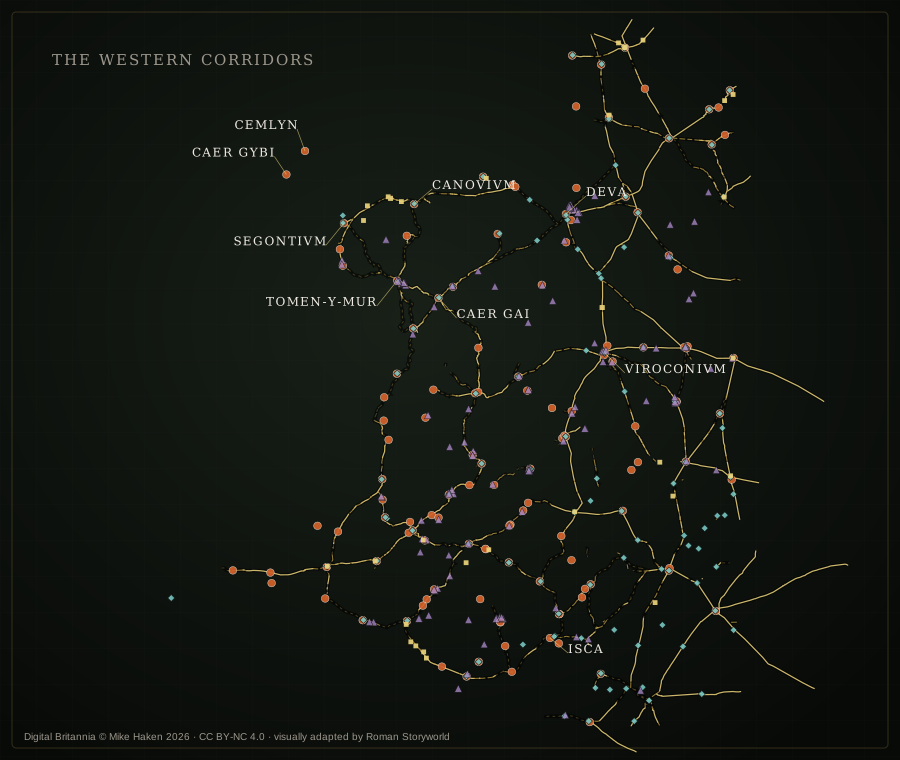
The Chester fortress and its settlement did not stand apart. Roads run towards Viroconium, north Wales, the Pennines and the coast, turning the fortress into a junction within a regional system.
In Wales, roads link forts and military vici, but they also create access to valleys, river crossings, mineral zones, coastal approaches and communities beyond the fort walls. Cadw describes Roman roads as a “spider’s web” connecting Roman Wales.3
Cadw records Segontium as linked by road to the legionary bases at Chester and Caerleon, while its position controlled access towards Anglesey and the coast.4 The road network was therefore terrestrial and maritime at the same time.
Regional finding
A fort marks a place where power was concentrated. A road reveals the territory through which that power had to move. Add settlements and camps, and the supposedly empty ground between forts becomes the central evidence.
VI · Authority beside the road
The dataset contains 137 milestone records, many with inscriptions, translations, dates, condition notes and links to the Roman Inscriptions of Britain database.5
The repeated message
Milestones could carry imperial names, dedications and distances. Beside the road, the inscription made administration visible in the landscape. Even where a traveller could not read every abbreviation, the dressed stone and official lettering announced organised power.
Some stones were re-inscribed when regimes changed. The road endured while the imperial name upon it could be erased, turned or replaced. Infrastructure outlived individual rulers.
The traveller passed the stone. The emperor’s name remained. Rain entered the letters; lichen softened the command. Yet the road continued beyond sight.
VII · After Rome
Historic England notes that Roman roads later became commercial routes, settlement and industrial foci, property boundaries, and—in many cases—the foundations beneath modern roads.2
A built route with drainage, camber and layers of stone or gravel.
The same alignment may continue while its surface and purpose change.
Ploughing, rivers and development remove or conceal parts of the road.
The route returns as a pattern that must be tested rather than merely recognised.
A Roman alignment may persist because later travellers chose the same practical corridor.
A durable linear feature can continue to divide land after its original surface is lost.
Stone spreads, crop stress, soil colour or a low agger may preserve the line imperfectly.
Earthworks hidden from ordinary aerial photography may emerge through LiDAR—but still require ground evidence.
VIII · The verdict
No.
The strongest evidence is not any single road. It is the repeated spatial relationship between roads, military sites, settlements, camps and milestones across Britain. The roads moved soldiers, but also messages, food, stone, animals, taxes, traders, craftsmen, officials, families and ideas.
That structure did not vanish neatly with Roman rule. Some lines remained roads. Others became boundaries, tracks, buried aggers or interrupted traces. Modern Britain does not simply contain Roman roads as archaeological objects; in places, it still moves through landscapes whose logic was reinforced by them.
3,572 road segments and approximately 12,348 km of geometry are present in this version of Digital Britannia.
Most recorded military installations, settlements and milestones lie within one kilometre of a recorded road segment.
Conjectured continuations require archaeological testing. Proximity alone does not establish date, direction of influence or continuous use.
Begin with a modern place and examine its wider Roman landscape.
Investigate a location → Method investigationSee how LiDAR can reveal a lost route—and how it can mislead.
Follow the evidence → Further explorationContinue into Roman Storyworld’s map and landscape resources.
Explore the maps → Research archiveRead the research papers behind the wider Roman Storyworld.
Browse the archive →IX · Method, licence and sources
digital-britannia_v1.gpkg, containing road, military, settlement, camp, milestone, wall and milecastle layers.
Calculated from the road geometry in EPSG:27700. Values are rounded and describe recorded geometry, not a claim about the exact total length built in antiquity.
Straight-line distance from each point feature to the nearest engineered road geometry. A 1 km comparison is used to show broad landscape association.
The evidence plates simplify line geometry for browser display and use new Roman Storyworld styling. No Google map, GIS viewer or external map service is loaded.
Required attribution
Licensed under Creative Commons CC BY-NC 4.0. Data selected, measured, simplified and visually adapted for this free Roman Storyworld investigation. The original GeoPackage remains the authoritative source for feature attributes and geometry.
Dataset analysed and page prepared: 23 July 2026.